Arrowleaf balsamroot blooms create a field of gold. These vibrant native western wildflowers are part of the sunflower family. Photo by USFWS. Tweeted by the US Fish & Wildlife Service, 8/18/17.
Pictured Rocks National Lakeshore in Michigan. Along its 42 miles of Lake Superior shoreline are over 15 miles of towering sandstone cliffs, 12 miles of beautiful beaches and 5 miles of sand dunes. You can climb to the top of a lighthouse, hike through forests, kayak past waterfalls or just lay on a beach. Photo by Betty Greene. Posted on Tumblr by the US Department of the Interior, 7/10/17.
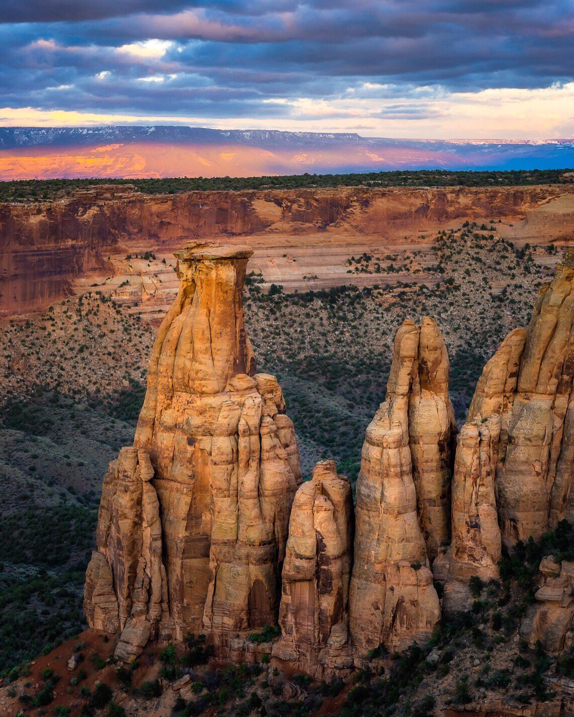
The gorgeous Guadalupe Mountains National Monument. Photo by Andrew Slaton. Tweeted by the US Department of the Interior, 7/10/17.
Located on the border of Wyoming and Montana, the Pryor Mountain Wilderness Study Areas rugged, isolated portions of the Pryor Mountain Range may be tough to get to but the view is worth it. Some areas are only accessible by ATV, horseback or on foot. In less than 13 miles, the landscape transitions through a wide spectrum of geologic and biotic features, ranging from desert environments to those found in sub-alpine mountainous settings. Pryor Mountain is approximately nine miles north of Lovell, Wyoming. Before venturing into this wilderness study area, make sure to check in with the Bureau of Land Management’s Billings Field Office and grab a map. Photo by Bob Wick, Bureau of Land Management. Posted on Tumblr by the US Department of the Interior, 7/15/17.
Greater sage-grouse on Seedskadee National Wildlife Refuge Photo by Tom Koerner/USFWS. Taken on 6/5/17 and posted on Flickr by the US Fish & Wildlife Service.
A Brewer’s sparrow perched on a Wyoming Big Sagebrush at Wyoming’s Seedskadee National Wildlife Refuge. Photo by Tom Koerner/USFWS. Taken on 6/5/17 and posted on Flickr by the US Fish & Wildlife Service.
White-tailed prairie dog on Wyoming’s Seedskadee National Wildlife Refuge. Photo by Tom Koerner/USFWS. Taken 6/5/17 and posted on Flickr by the US Fish & Wildlife Service.
Horned lark on Seedskadee National Wildlife Refuge Photo by Tom Koerner/USFWS. Taken 6/8/17 and posted on Flickr by the US Fish & Wildlife Service.
As night falls on Devils Tower National Monument, it transforms from a place of darkness into a place of wonder. Thousands of twinkling, glittering stars dot the night sky over an astounding geologic feature that protrudes out of the rolling prairie surrounding the Black Hills. Stay for nature’s night show at Wyoming’s Devils Tower – it’s worth it! Photo by National Park Service. Posted on Tumblr by the US Department of the Interior, 4/18/17.
Arizona’s Saguaro. Photo by David Olsen. Tweeted by the US Department of the Interior, 12/16/16.
Kofa National Wildlife Refuge is the second largest wilderness area in Arizona. A campaign by the Arizona Boy Scouts helped establish the refuge in 1939 to protect desert bighorn sheep and other wildlife. The refuge’s name – Kofa – comes from an acronym for one of the area’s most notable mines, the King of Arizona gold mine. Photo of mountains, palo verde & brittlebush by Brian Powell. Posted on Tumblr by the US Department of the Interior, 8/18/16.
Taking its name from one of the longest living trees in the Arizona desert, the 129,000-acre Ironwood Forest National Monument is a true Sonoran Desert showcase. Keeping company with the ironwood trees are mesquite, palo verde, creosote, and saguaro – blanketing the monument floor beneath rugged mountain ranges named Silver Bell, Waterman and Sawtooth. The national monument also contains habitat for the cactus ferruginous pygmy owl and desert bighorn sheep. Photo by Bob Wick. Posted on Tumblr by the US Department of the Interior, 3/24/17.
Death Valley National Park is famous for its spectacular spring wildflower displays. While the intensity of the bloom varies greatly from year to year, flowers are never totally absent. This year, wildflowers are generally sparse along popular scenic routes, but intrepid photographers like Michael Hardridge are finding desert sand verbena blooming at Ibex Dunes, a remote area that requires a 4-wheel drive vehicle and good route finding skills. Sunset photo taken on March 4 by Michael Hardridge. Posted on Tumblr by the US Department of the Interior, 3/18/17.
California’s Mojave Trails National Monument erupts in color with spring blooms. Tweeted by the US Department of the Interior, 3/16/17.
Amboy Crater is just one of the sights in the Mojave Trails National Monument, on historic Route 66. Photo by Bob Wick, BLM. Tweeted by the US Department of the Interior, 3/15/17.
Only a few hours from Los Angeles, Carrizo Plain National Monument offers visitors a chance to be alone with nature. Prominent features of the monument include the white alkali flats of Soda Lake, vast open grasslands and a broad plain rimmed by mountains. When conditions are right, numerous wildflowers can carpet the valley floor, creating a beautiful, but temporary landscape of color. Photo by Curtis Kautzer. Posted on Tumblr by the US Department of the Interior, 3/20/17.
Located about 8 miles north of I-10 at Desert Center, Desert Lily Preserve Natural Area in California was established in 1968 to protect 2,000 acres of prime wildflower habitat. Popping up in patches of purple desert verbena, yellow desert dandelion, and bright evening primrose and white desert lilies, these gorgeous wildflowers carpet the floor of the Chuckwalla Valley as far as the eye can see. The hike to the most dense bloom is a half mile from the Bureau of Land Management parking area, so be prepared for a short walk. Photo by Bob Wick. Posted on Tumblr by the US Department of the Interior, 3/28/17.
The Iditarod National Historic Trail in Alaska encompasses a 1,500-mile system of winter trails that first connected ancient Alaska Native villages, opened up Alaska for the gold rush and now plays a vital role for travel and recreation. Maintained by the Bureau of Land Management, the trail is now mostly closely identified with the famous annual sled dog race, which challenges the racer and the 21 dog team with harsh conditions across rugged, but beautiful terrain. Photo by Kevin Keeler, Bureau of Land Management. Posted on Tumblr by the US Department of the Interior, 3/5/17.
Travel back in time at Hovenweep National Monument where six prehistoric, Puebloan-era villages spread over a 20-mile expanse of mesa tops and canyons along the Utah-Colorado border. Multi-storied towers that are perched on canyon rims and balanced on boulders lead visitors to marvel at the skill and motivation of their builders. Newly retired Gary German snapped this wonderful sunrise photo while enjoying his morning coffee from the park’s Sleeping Ute Mountain. Posted on Tumblr by the US Department of the Interior, 3/8/17.
A perfect place for a winter hike: Mineral Ridge Trail at Coeur d’Alene Lake. Tweeted by the US Department of the Interior, 3/2/17.
The superbloom has migrated north to California’s Central Valley, and the show is simply indescribable at Carrizo Plain National Monument. The Valley floor has endless expanses of yellows and purples from coreopsis, tidy tips and phacelia, with smaller patches of dozens of other species. Not to be outdone, the Temblor Range is painted with swaths of wildlflowers in oranges yellow and purple like something out of a storybook. Visitors are flocking to the area to see this explosion of color, and travelers should be prepared with a full tank of gas as there are no services in the monument. Photos by Bob Wick, Bureau of Land Management. Posted on Tumblr by the US Department of the Interior, 4/4/17.
A gorgeous sunrise at Canyonlands National Park in Utah. Photo by Greg Sager. Posted on Tumblr by the US Department of the Interior, 1/1/17.
Bryce Canyon National Park has the world’s largest collection of hoodoos. Here is a fabulous view at sunrise. Photo by Jennifer Fast. Tweeted by the US Department of the Interior, 1/26/17.
Sunrise over Arizona’s Tonto National Monument. Tweeted by the US Department of the Interior, 1/11/17.
Wake up to stunning winter sights with year-round camping at New Mexico’s Organ Mountains in the Desert Peaks National Monument. Tweeted by the US Department of the Interior, 1/11/17.
One of President Obama’s final acts in January was to expand the California Coastal National Monument. Tweeted by the US Department of the Interior, 1/12/17.
In January, a 22-acre section of a lava delta in Hawaii Volcanoes National Park broke apart and sank into the ocean causing the closing of a viewing area. Now, from the new viewing area, visitors can witness a “fire hose” of lava streaming into the ocean. The molten rock sends huge clouds of steam and gas into the air as it hits the Pacific. It’s a sight you’ll never forget. Photos by National Park Service. Posted on Tumblr by the US Department of the Interior, 1/13/17.
California’s Channel Islands National Park. Photo by George H.H. Huey. Tweeted by the US Department of the Interior, 1/10/17.


")